September 3-5, 2011 (Labor Day)
Escalante State Park
Dave, Christine, Mike
We left about 5:15 PM on Friday, September 2nd. However, our reservation didn’t start until Saturday. The plan was to stop at the Flying J in Beaver and spend the night in the 5th wheel, but as we traveled south on I-15, we turned on the GPS. The GPS lady said to take the exit by Scipio (a small town), which was an alternate way to go. Feeling adventurous, we decided to go that way, which was a new way for us.
It was getting dark by then, but we faithfully followed the GPS lady’s directions. Twice, she took us on half-loops that went on unpaved roads and then brought us back to the road we’d been on originally. On one of these loops (really more of a U), we saw two deer, so that was fun. Back on the main road we saw something in the road (it was fairly dark by then) and had to swerve to avoid a deer curled up and sitting in our lane. We hope he wasn’t hurt—not sure why he was sitting in the road. We saw another deer on the side of the road earlier too, so we saw 4 deer.
On one of the detours, we drove past a house kind of out in the middle of nowhere. A family was bar-b-quing on their front porch and they stared at us as we drove past, probably wondering what in the world we were doing driving past their house on a seldom-used dirt road pulling a 5th wheel.
Eventually the GPS lady told us to turn off of the highway onto an unpaved road. We did. (Why? You may ask. It was dark and we couldn’t tell it was unpaved until we’d already turned onto it, and it’s difficult to turn around when pulling an RV, so we decided to go forward.) We had to drive about 40 miles. Since we couldn’t go faster than 25 - 30 miles per hour, it took a while (The name of the road turned out to be “The Devil’s Backbone”!) It was about 10:00 PM when we started on this road, so we were getting tired.
Two different times, a rabbit ran across the road in front of us. The drive looked like it would be a pretty during the day, but we were tired and it was dark. The road actually wasn’t too bad for an unpaved road, but it was bumpy at times. As we approached the end (according to the GPS at least), Dave noticed that the light for the trailer brakes wasn’t on (this is a small light near the driver that is green when the trailer brakes are not applied, and turns orange/red when the trailer brakes are applied), and we’d been going downhill. He got out of the truck and we could smell the distinct odor of overused truck brakes. All the bouncing around had caused the brake plug to come out, so we'd been using only the truck brakes to slow the truck AND trailer. Not good. Luckily, Dave just had to plug the cord back in, and we were one our way.
Twice along the way we had to stop and use a flashlight to check a sign to make sure we took the correct fork in the road. Also, a few times we saw RV’s well off the road, camping. We considered doing the same (evidently it was BLM land where you can camp if you want), but it didn’t seem wise to drive off of the road while pulling the trailer when we wouldn’t be able to see where we were going. Plus it was just Dave, me, and Mike and it creeped me out to be away from everyone when who knows who was out there.
At about 11:45 PM, when we reached the end of that leg, the GPS lady told us to “turn right”, but the scenery looked the same. We were expecting to reach a paved road, but didn’t see anything. Then we noticed a road sharply to the right. We would have to make a U-turn with the 5th wheel to go that way and it seemed to lead off into the darkness.
After stopping in the middle of the road (not that there was ANYONE around), Dave took the flashlight and walked down the road the GPS lady wanted us to take, to see where it led. He discovered that it led to a creek and then seemed to stop. We decided to continue on the way we’d been going and the GPS lady recalculated. Fifteen minutes later we reached the town of Escalante.
Needless to say, we bought a map of the area the very next day!
So it was about midnight when we reached Escalante. First we drove to the campground to see if our spot happened to be empty (though we weren't due until later that day). It wasn’t. Then we drove through town, looking for an inconspicuous place to park. There was a large motel (Prospector’s Inn) and we pulled into the parking lot. At the end of the parking lot was a large gravel area. We pulled in there, got ready for bed, and went to bed. We slept with the slide-out slid in so it wouldn’t be obvious that we were sleeping in there.
We slept without incident. Saturday at 7:00 I woke up and got dressed. Mike and Dave got up too. A short time later we pulled away from the Inn and drove down the main street, looking for a place to eat breakfast (I didn't want to prepare a meal in the trailer until we got to our campsite). We didn’t see any place to eat, so we pulled into a gas station and asked where a place to eat was. Ironically, he sent us back to Prospector’s Inn where there was a restaurant.
We had a good breakfast, then drove back to the campground to see if the people in our spot had left. They hadn’t. It was 8:30 AM. We went back to the Visitor’s Center, which is where we bought the Utah Almanac. Then we went to the Escalante River Trailhead and began the Escalante Natural bridge hike.
Right at the beginning we had to cross a stream about ten feet across and less than a foot deep. We took off our shoes and socks to cross it. Both banks had deep sand, so it was fun to be barefoot. We put our shoes and socks back on and continued on.

Mike after we crossed the creek
Apparently we missed the place where you are supposed to cross the creek again, because as we went on, the trail became hard to see and difficult to walk through, but we kept going.

Mike and me on the Escalante River trail
Eventually we had to stop because the only options were to jump in the river or climb a rock wall. Here is a video of what the area looked like.
Here's a funny video of Mike jumping across a narrow section of the stream. He thought the other side was a little more stable.
We turned around and headed back and saw a group of people crossing the river at the place we missed. We were ready to get to our campsite, so we headed back to the beginning of the trail and got back to our truck. We drove to the campground and arrived just before 1:00 PM. The people had left and we were able to pull in to our spot and get settled.
On Sunday we drove out on the Hole in the Rock road to the Dry Fork Road trailhead. There are several slot canyons there. We hiked three of them: Dry Fork, Peek-a-boo, and Spooky. There were some extremely narrow areas, but it was fun.
We also had to do a bit of climbing from time to time. In fact, to even get started on one of the slot canyon hikes, we had to climb up about 25 feet to get into the opening. It’s harder to climb down it (for me) than to climb up. Here's a video of me climbing up. You can judge if my 25 foot guess is accurate. I'm not very good at telling measurements. The rock is sandy, which makes it slippery and I was afraid of slipping and falling!
The hike back to the car was strenuous as we were tired and there were a lot of uphill sections. All told, we were there nearly four hours. Next time we need to bring more water. We had 4 16-ounce bottles and Mike had his Camelback, but we could have used more. It was a fun time.
Here are a few more pictures from that hike:
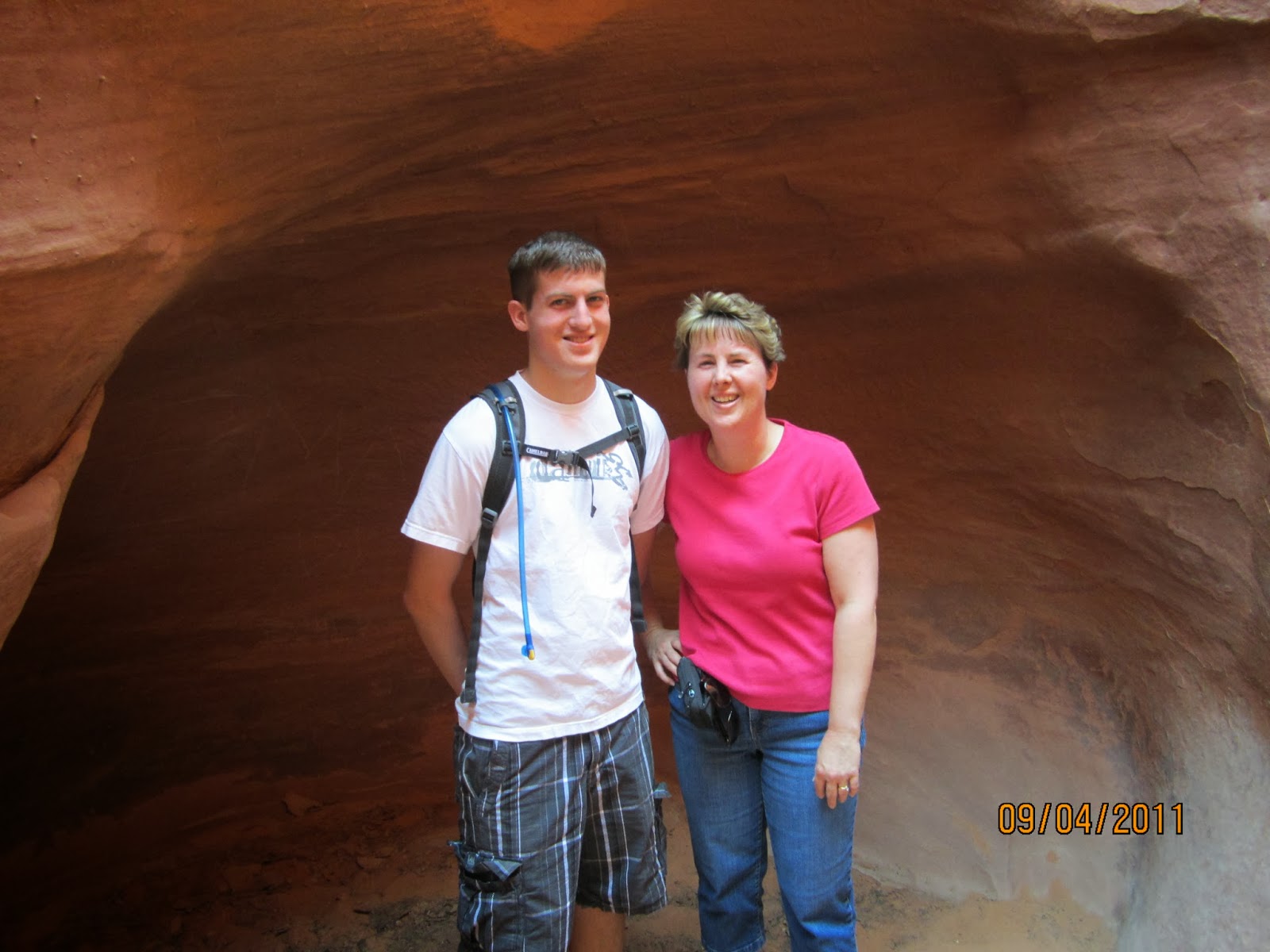
Mike and me

Mike

Mike
On the drive back we saw this sign and thought it was funny.

Dave in the cat pasture


